13.Futaenotouge Mountain Pass Geosite

Myths and history
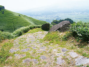
This geosite offers insight into the formation of Aso Volcano through the topography of the caldera, central cone group, Kurokawa river and oxbow lake on the caldera floor. Futaenotouge Pass, which is the geosite's central feature, is said to have gotten its name from a local myth. The name means "double-layer pass," and refers to a legend in which the god Takeiwatatsunomikoto attempted to kick down the wall of the outer rim but was unable to because it was two layers thick.
Futaenotouge Pass
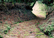
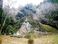
An elevation 683 mountain pass. According to legend, the pioneer god of Aso Takeiwatatsunomikoto wished to turn the caldera basin into a fertile agricultural plain, but it was filled with a huge lake. To drain the lack he kicked at the wall, attempting to break a hole in it and drain the water away. No matter how hard he kicked, however, the wall did not break. When he looked closely at the section he was attacking, he realized it was two layers of thick. This is how the pass got its name. Stone pathways over the pass offer evidence of its more recent history: local lords traversed the pass on their way to Tokyo, where they were required to reside for set periods of time in the days when Japan was ruled by feudal clans.

Sankin-kotai Road
During the Edo era, this road was used by local daimyo traveling to Edo (current-day Tokyo), where they were required to spend fixed periods of time. The well-made byway is part of the Bungo Road, which runs from Kumamoto Castle to Oita. This section includes ignimbrite, a volcanic rock.


